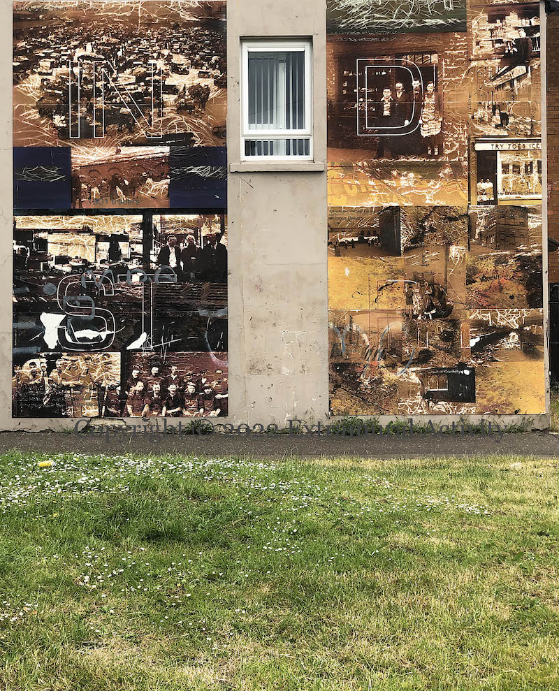
Artist Raymond Henshaw produced a series of Markets-related boards in 2008-2009 with support from the Arts Council and despite being printed on laminates they are not indestructible; there is crazing – as well as human-caused damage – on some of them, the worst of which is the ‘Industry’ board in Upper Stanfield Street.
Tillie & Henderson’s shirt factory opened in 1856 at the junction of Abercorn Road and Foyle Road, Derry (next to the ‘Hands Across The Divide’ statue) and survived until 2003 when it was demolished after a fire (BBC); an apartment block is currently planned for the site (Derry Journal | BBC). It was the largest such factory in the world and one of 44 shirt factories in the city in 1900, all of which employed women, many starting in their teens.
Michael Blakstad’s Children In Crossfire is a justly famous documentary portraying the lives of children in Creggan (Derry) and various areas of Belfast, such as Ballymurphy & Springmartin, Divis, and the area around Gawn St in east Belfast. The documentary is on youtube and an image from it (c. 28m 13s) is depicted in this mural (Connswater Chronicle) at the foot of the Dee Street overpass into what is now the “Titanic Quarter”.
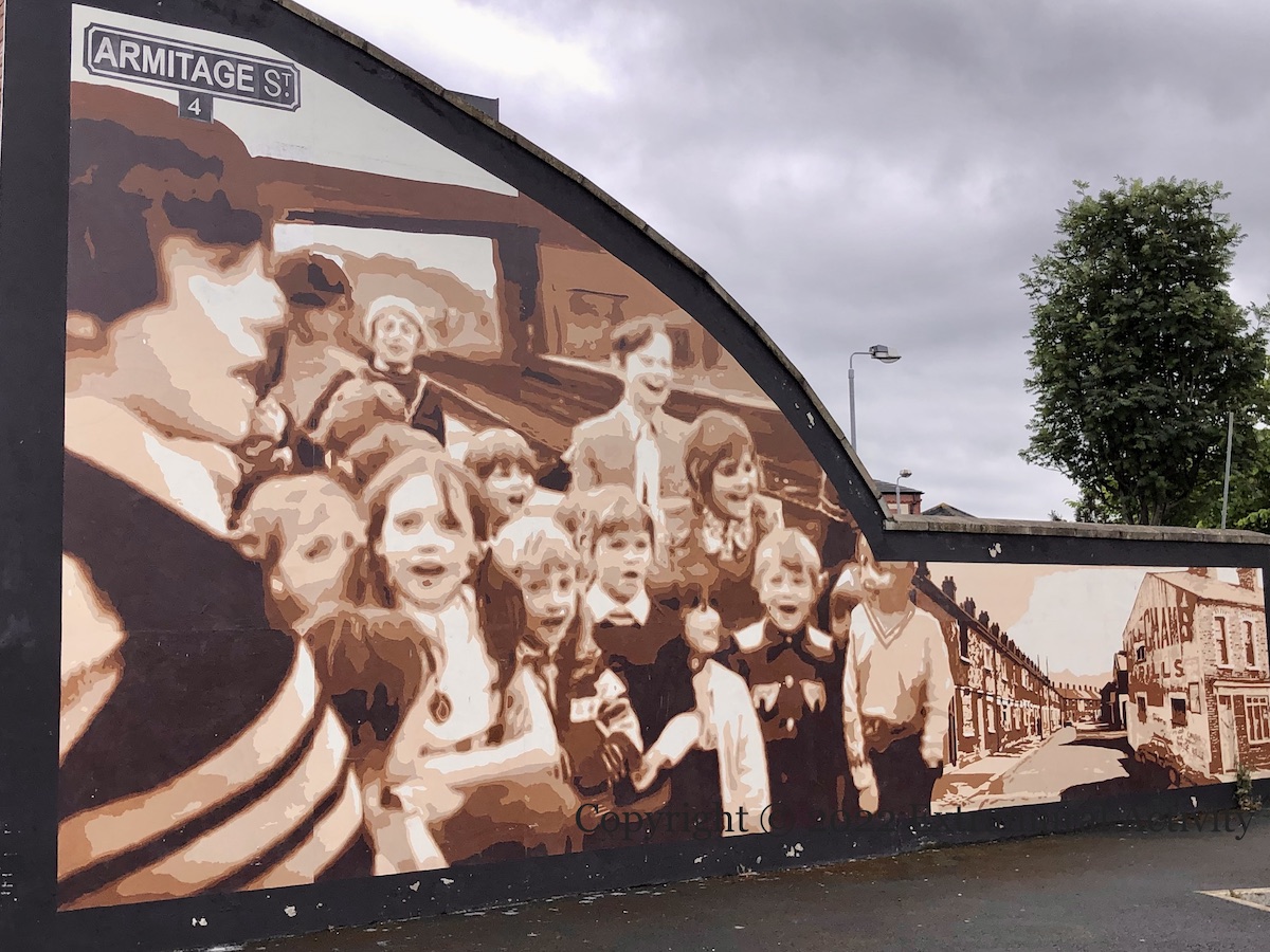
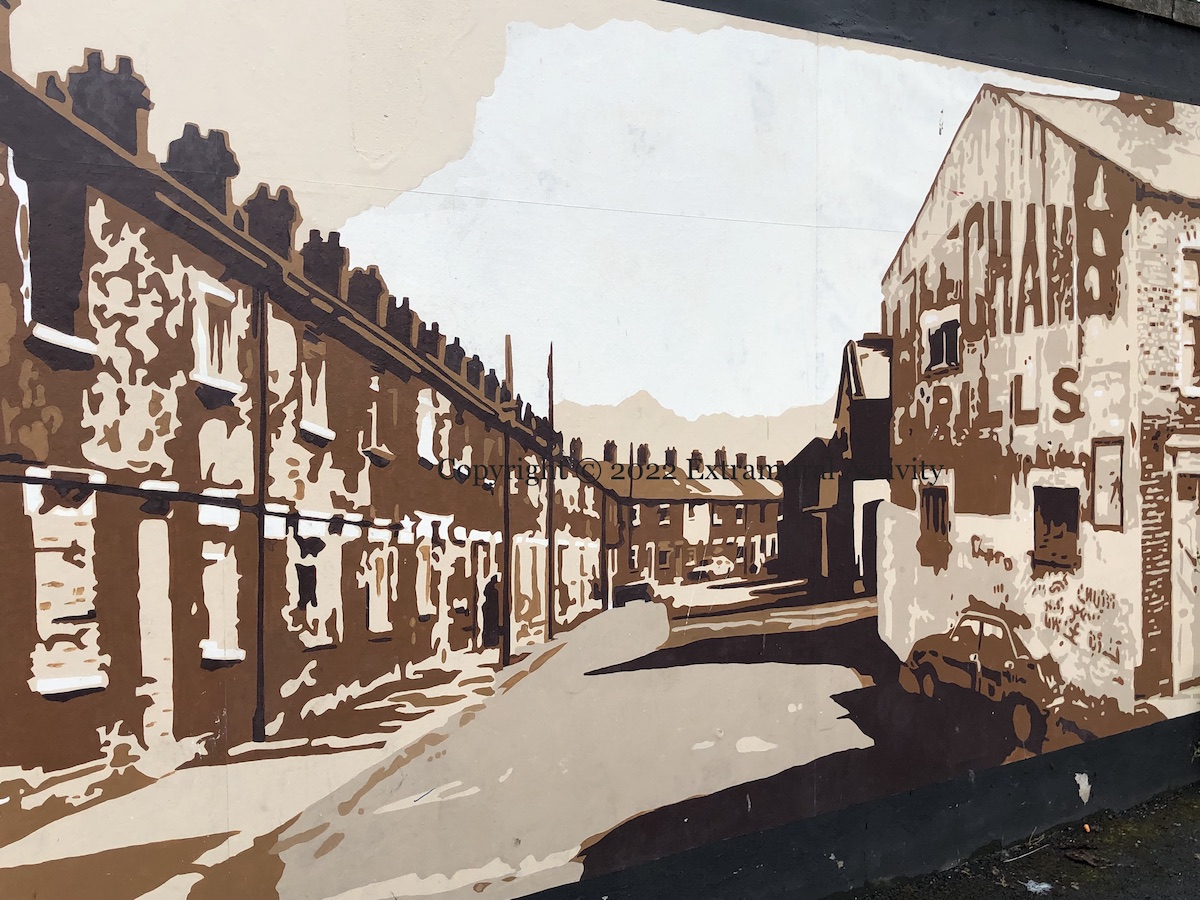
The panel to the right shows the original Armitage Street; the area has been redeveloped and the street was built over with a cluster of houses named Armitage Close.
By Dee Craig with support from the Housing Executive, City Council, and Connswater Homes.
Soccer player James McClean grew up in Creggan and – while playing for a succession of English clubs – has been criticised for refusing to wear a poppy (while at Sunderland) and turning his back on the St George’s Cross as ‘God Save The Queen’ played (while at West Bromwich Albion). He also has a tattoo of Free Derry Corner flying a Tricolour on his thigh (Irish Times).
In the mural (by Dublin artist Aches (ig)) McClean is pictured here in an Ireland strip – McClean has 7 caps for the Northern Ireland under-21 squad but plays senior soccer for Ireland (WP).
“A scramble for the window seat/Steam curls as the whistle blows/Clickety clack train on track.//Remember your neighbourhood in the late afternoon sun/The district was a different place then/All you owned was a box full of toys and a smile on your face.”
The York Road railway station was a few minutes’ walk below Ritchie Street – site of this mural and community garden – until it closed in 1992. The original line was to Ballymena and then Coleraine and London-/Derry, with service to Carrick and Larne added later. It was badly damaged in WWII and its final demise came with the opening of Belfast Central in 1976 (WP). It was replaced with Yorkgate in 1992 which no longer serves as a terminus (WP), but the line still runs along behind the end of the streets along York Road and the Grove area of the Shore Road.
This is a new mural by Peaball (Fb) and emic (Fb) in Glenview Street, Derry, inspired by the chat on the Golden Years club at the Glenview Community Centre (tw).
The Nissen huts that form the background are perhaps a reference to the US WWII camp in nearby Springtown that was used to house Catholic families from the end of the war until the 1960s (Gavin Pattondocumentary | WP).
The referents of the central portrait and of the title are unknown.
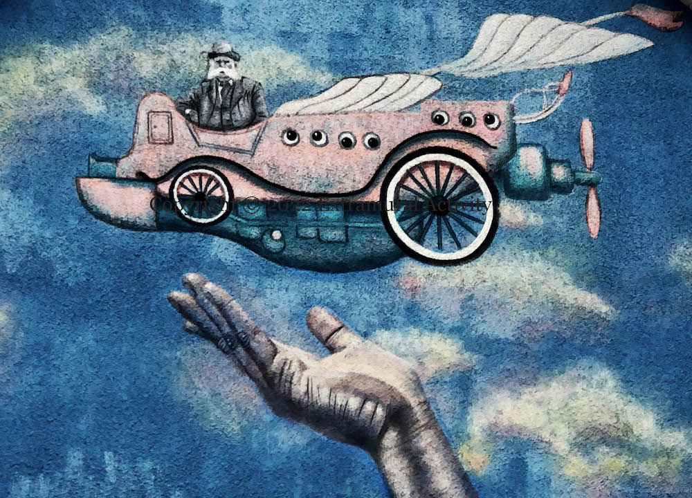
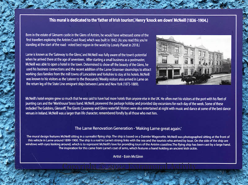
Hotelier Henry McNeill, it is reported, brought the horseless carriage to Larne in 1899, in the form of a Daimler Wagonette that he used to ferry guests up and down the coast and in to scenic spots in the Glens Of Antrim – the mechanical future combined with of the timeless beauty of the natural world. Here is a photo of McNeill aloft in 1899; emic (ig) recasts the image as though he were at the helm of a flying machine.
The city of (London)Derry takes its named from the Irish word “doire” meaning “oak wood” (and generically a “grove”) and the oak leaf is often used as a symbol of the city (here are 11 murals with oak leaves from the Peter Moloney Collection – Murals). In the mural above, in addition to the three leaves on the right-hand side, we also have some acorns.
The moniker “maiden city” is derived from the city’s resistance to sieges throughout its history, most famously in 1689 (again – a variety of images from Peter Moloney). The walls of the old city are shown above the river Foyle, with landmark buildings such as the Peace Bridge (see Waterside, Cityside, Quayside) behind them.
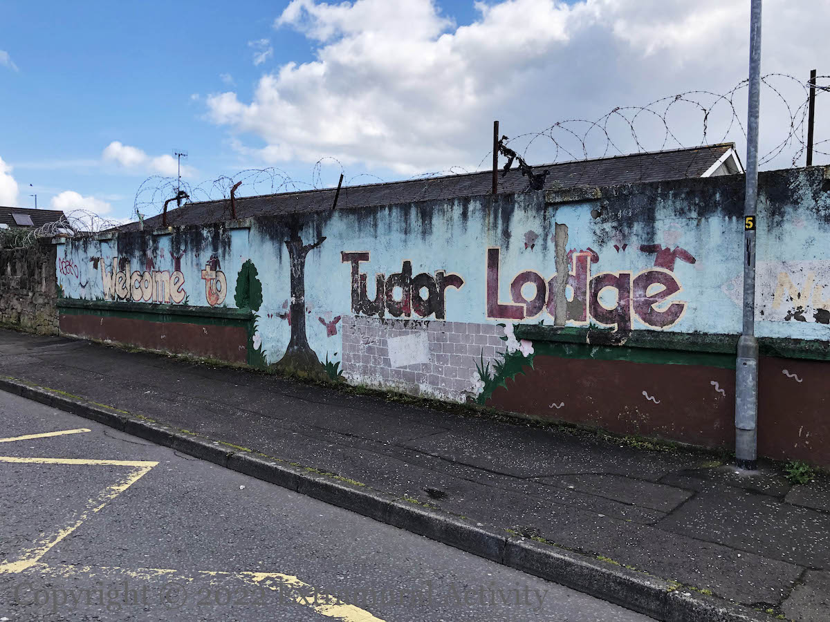
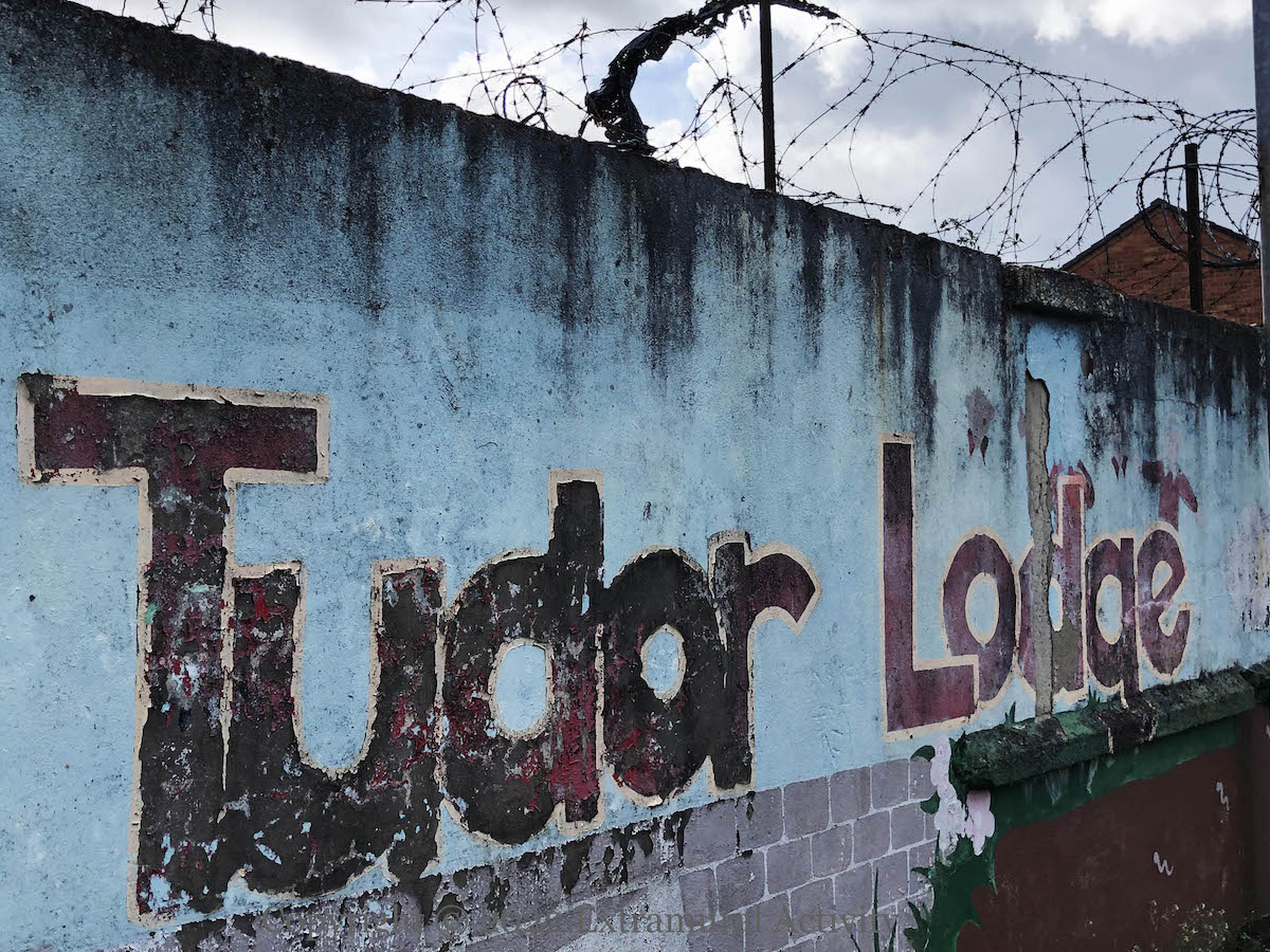
Tudor Place (the street) is now simply the top end of Crimea Street, but in years past it was physically separated and accessible only from the Crumlin Road. The reason for that seems to be that in the 1800s it was the grounds of a lodge, called Tudor Lodge. The nursery school is on the site of the old lodge (which is not the lodge known as Old Lodge) and takes its name.